
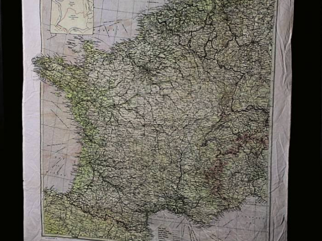
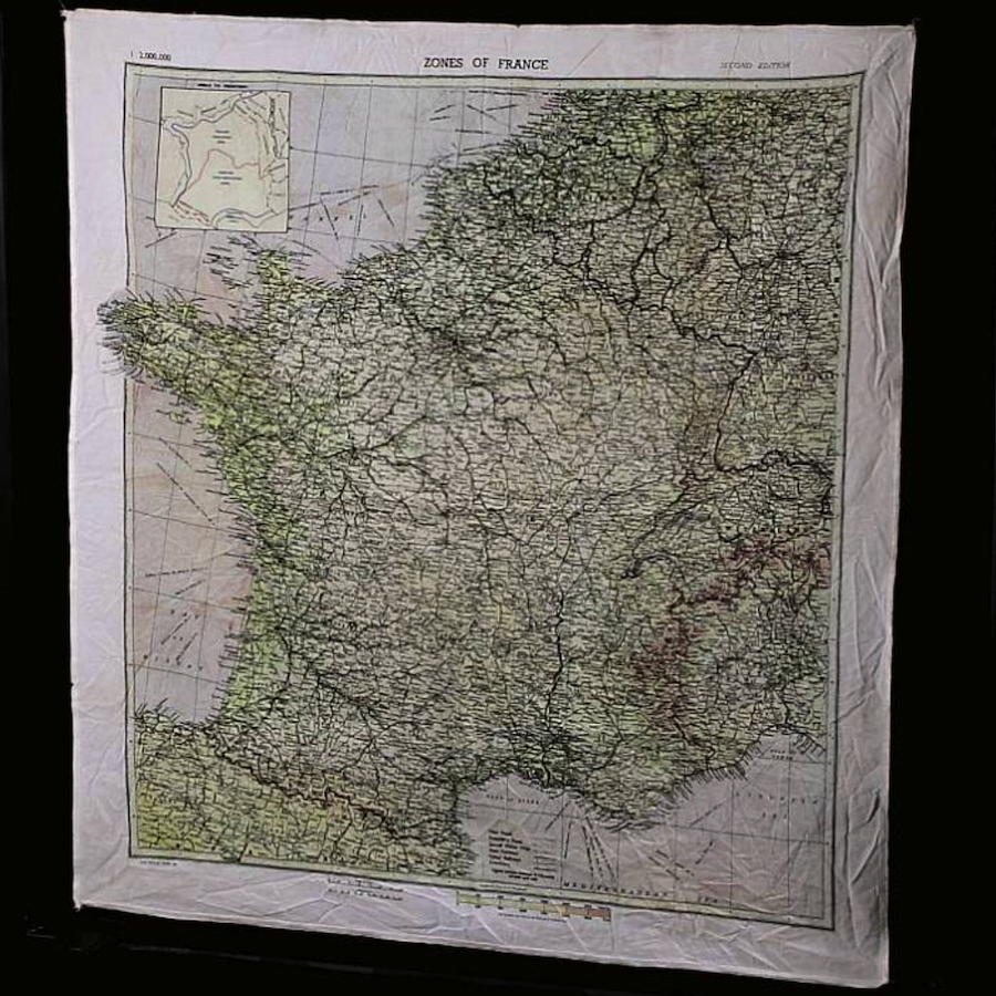
Replica of 'Zones of France' silk (rayon) map, 2nd Edition. On D-Day, this map was mainly used by US airborne troops who wore it around their necks. Silk maps were used because they did not make noise or tear easily, and they were easy to conceal. They allowed soldiers to find their way to safety if caught behind enemy lines.
Issued pre D-Day, 4 March 1944, to Intelligence School #9, Western Europe, M19, to U.S. airborne troops and special forces operating behind enemy lines. Developed with the aid of the OSS and French Resistance, Britain’s military Intelligence Section, M10. Shows World-War-II military occupation zones. Includes inset of named occupation zones: Index to frontiers and legend. The division between occupied and non-occupied zones shown by dotted lines and arrows. Map covers parts of Belgium, Germany, Switzerland, Italy and Spain. Shows roads, railways, frontiers, rivers and lakes. Relief shown by gradient tints and spot heights. Prime meridian is Greenwich. Measures 58 x 56 cm.
Artifact Information
1944
Originals printed by the company of John Waddington, Ltd.